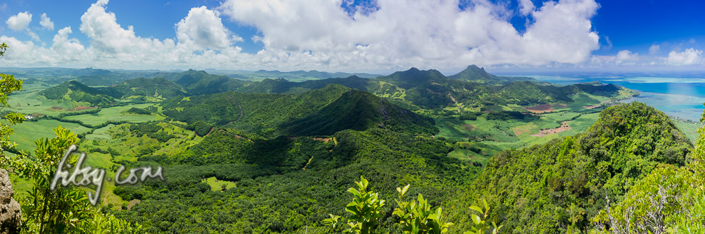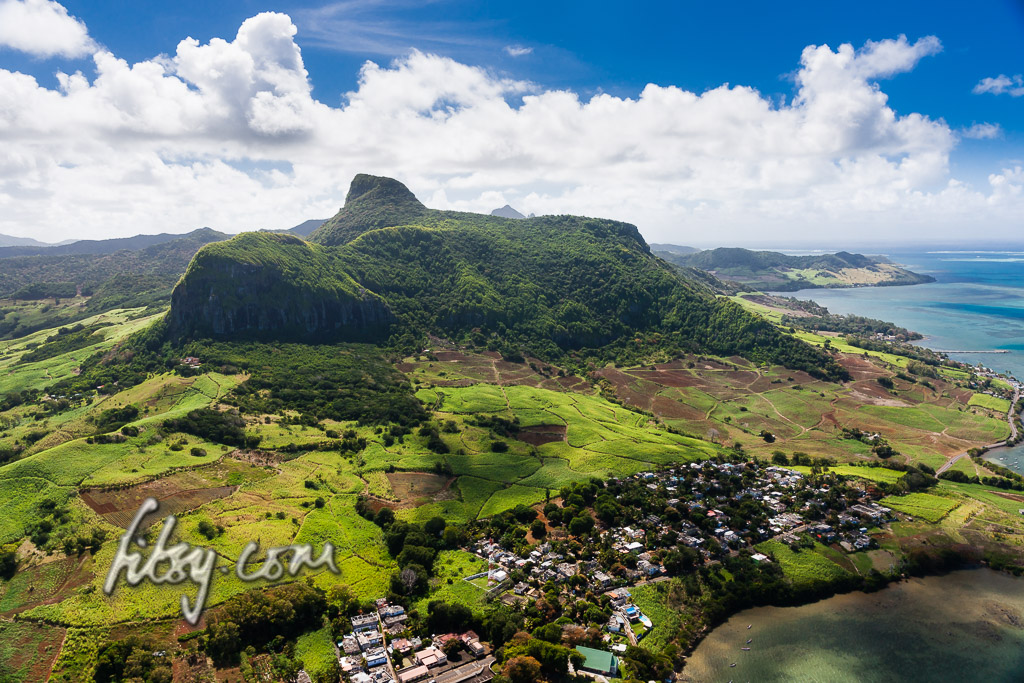
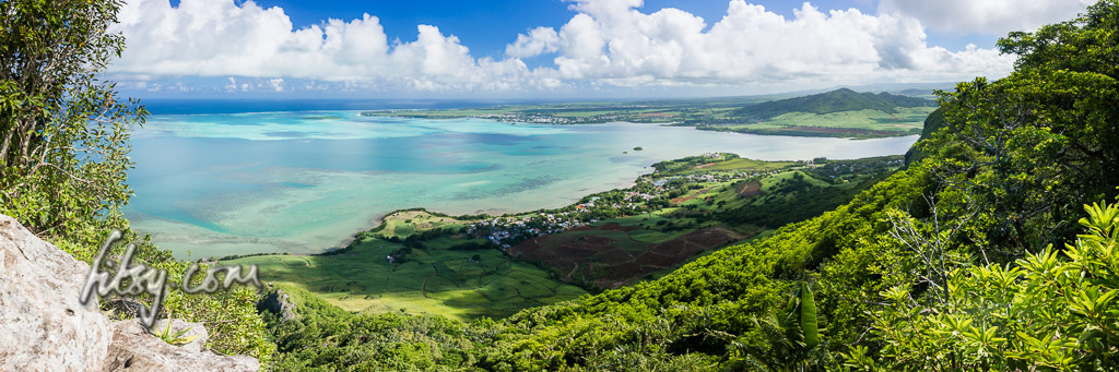
Lion Mountain is a moderate climb with a couple of hurdles along the route but which can be accomplished by any agile adult or teenager. The location provides some great views over the bay of Mahebourg, the lagoons of the south east coast and inland over the landscape of the Bamboo mountain range.
Location
Lion mountain is located in the South East of Mauritius, overlooking Grand Port and the bay of Mahebourg.
The starting point of the route is at the Police station of Grand Port on the coastal road. There is a road aptly called Lion Mountain Road adjacent to the Police station, off the main coastal road.
The area is served by buses travelling from Mahebourg to towns in the eastern region of Mauritius such as Flacq and Bel Air.
The track starts from the Police station along Lion Mountain Road, past some houses until you reach sugar cane fields. You may leave your transport in the clearing at the end of the tarred road just as you enter the sugar cane fields but avoid blocking the road to large agricultural vehicles which may be at work in the fields during the sugar cane harvest.
Route Description
- Make your way to the Police station of Grand Port.
- Lion Mountain Road is adjacent to the police station, follow this road, keeping to the left at the split, and continue until you leave the housing area and reach the sugar cane fields.
- Depending on whether the sugar cane has been harvested, you should be able to see a small area at the base of the mountain which has been cleared for agricultural use. Follow the track along the untarred road until you reach this area.
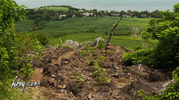
- Continue across this agricultural area, taking care not to step on any plants, towards the mountain, and depending on whether there has been recent rainfall, you should cross a small stream and start a climb across what seems to be a rain-water drainage gully in the mountain.
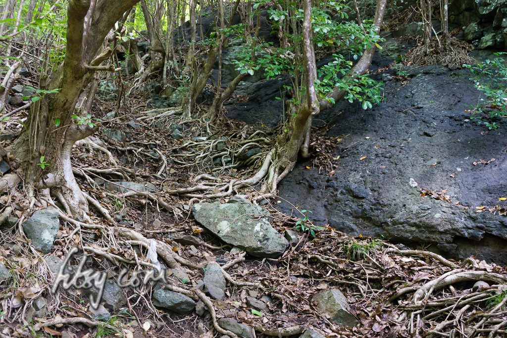
- After a few metres, the track will come across a large boulder which you must climb in order to continue. This might seem daunting, but can easily be accomplished by climbing it head on, or by using the trees growing to the right as support to help you up.
- The path continues quite steeply in some places, but by using the roots of trees growing to the side of the track, this will make the climb easier.
- You will emerge at a large rock face where you will be faced with a choice. If the rock is dry, and it doesn't seem too daunting to you, you can turn right and follow the path which will take you to the ridge at the top of the mountain. Or, you may choose to keep going forwards across the tall trees and leaves on the ground, where you will reach the ridge and follow the path to the right. You will end up at the same point.
- Once at the top of the ridge, the terrain is much flatter, and there is a short walk towards the summit of the mountain.
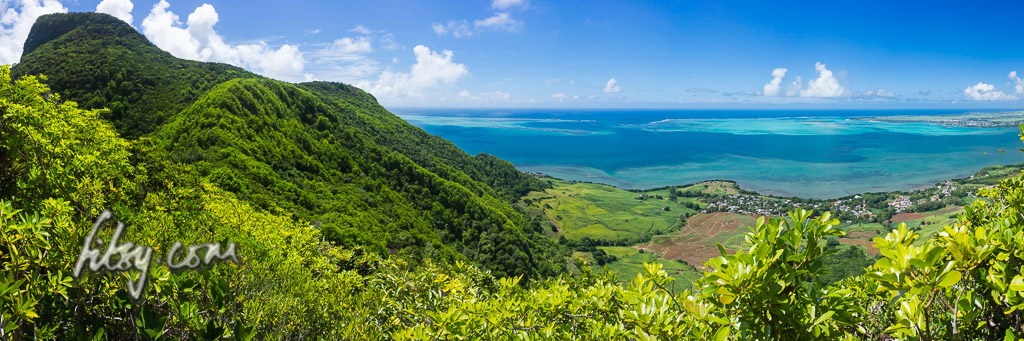
- As you continue North-Eastwards, after the paths turns muddy, there is a track towards the East of the mountain which will take you to a viewpoint over the bay of Mahebourg. I recommend you visit this viewpoint on your way back down from the summit.
- The path gets progressively steeper and will direct you towards the North West. You will reach what seems some large boulders with some trees growing to the side of them. Check the GPS for the location as it is easy to miss the point where you have to climb these boulders and rocks to continue onto the path towards the summit.
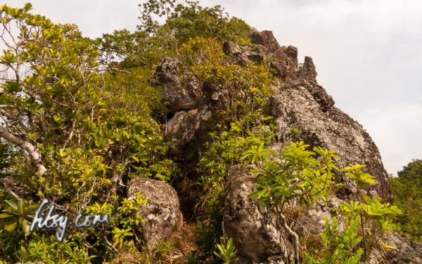
- Once you have climbed the first part of these boulders, you will emerge from the trees with views of the coast available to you. Continuing along the path, after a further few metres, you will need to pass through a small space through two large boulders. Care is required at this point, as when you emerge from the gap in the boulders, there is a sudden drop where an ageing and now rusted steel net has been placed to prevent hikers from falling. Help the other members of your group past this hazard.

- The path then continues, without any further obstacles, to the summit where you can enjoy the views over the island and the lagoon.
- You will note on the openstreetmap below that there is a path from the Eastern Viewpoint leading down to the start of the track by the police station. You may also use this path but I'd recommend that you take it on your way down as it is a little longer than the path described here.